


Parnitha topoguide app for iPhone and iPad
Developer: Ubicarta
First release : 19 Feb 2018
App size: 28.26 Mb
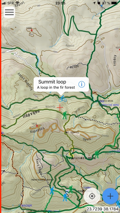
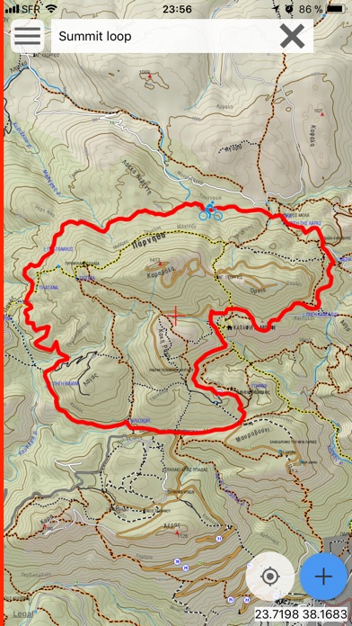
Mt. Parnitha topoGuide is a digital field guide for hikers, bikers and nature lovers. It includes routes, descriptions and photos for 39 hiking and mountaineering trails, 16 mountain bike (MTB) routes and 6 mountain running trails, which spread throughout the Mt. Parnitha, near Athens, Attica, Greece. These 60 Adventures cover the whole Mt. Parnitha mountain range. Each Adventure has a description, photos and a POIs list.
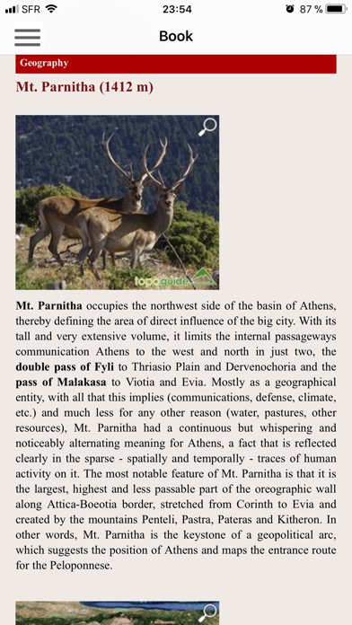
The application offers detailed offline maps and an extensive introduction on geography, geology, the ancient defensive system, the history and the nature of Mt. Parnitha. The app offers also a useful list of POIs with a comprehensive search engine.
The trails list includes easy walks, easy and moderate hiking trails and long mountain traverses, of a total length of 300 km.
The MTB routes cover all levels of difficulty and sum a total length of 300 km.
The mountain running trails include all mountain running courses actually done on Mt. Parnitha.
The cartographic company AnaDigit, creator of the application, has issued previously detailed hiking maps at a scale of 1: 25,000 for Mt. Parnitha, as well as hundreds other hiking maps for Greece (eg. maps of Crete, Zagori, Sifnos, Naxos and other Aegean islands). To build the application and ensuring data accuracy, all tracks of Mt. Parnitha have been recorded again during 2015.